Výpustek Cave - characteristics
MORAVIAN KARST
It is the largest and most important karst region in the Czech Republic. It is situated north of Brno as a part of the Drahanská Highlands with an area of 94 km2 of Devonian limestones (width 3–5 km, length 25 km). Due to its hydrographic conditions, it is divided into the northern segment – the Punkva River System, the middle segment – the Křtinský and Jedovnický Brook System and the southern segment – the Říčka River System.
VÝPUSTEK CAVE
-
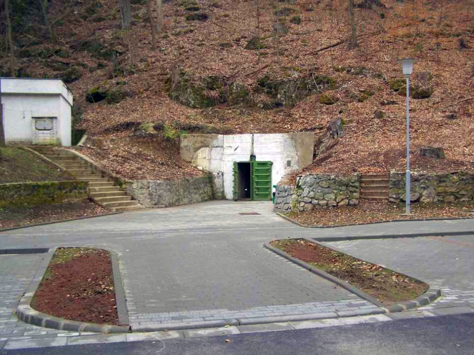
It is situated in the central part of the Moravian Karst in the upper section of the Křtiny Valley not far from the village of Křtiny in the Moravian Karst nature reserve.
-
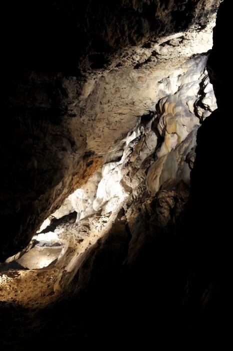
It forms two subterranean levels of the ancient ponor system of the Křtinský Brook.
-
It is a significant paleontological locality, one of the few European sites where complete skeletons of early Quaternary (Pleistocene) fauna can be found.
-
The total length of all the spaces known today is ca. 1,300 m with denivelation of 55 m.
-
In the period of speleological explorations in the 18th century it was considered the largest cave in Moravia.
-
During the 20th century it was intensively used for exploitation of phosphate clay, as an army depot, German armament factory, and secret command post of the Czechoslovak People's Army; in spite of that some parts were preserved in the natural state.
-
Both its nature and history are represented during the 550 m long sightseeing tour; the cave tour takes 60 minutes.
-
air temperature: 7–9 °C (46 °F), relative humidity: ca 95 %.
DEVELOPMENT OF THE CAVE SYSTEM
In total, there are more than 1,100 caves and abysses in the Moravian Karst. They were formed by gradual erosion and corrosion activities of atmospheric water and its subterranean streams in tectonically disturbed and relatively soluble layers of limestones.
The Výpustek Cave system was created in several development phases due to ponor activities of the Křtinský Brook and its tributaries. The extent and the arrangement of underground spaces probably even influenced the underground drainage of the Babická plain.
There are two levels of the Výpustek Cave. From the point of view of development, the older spaces of the upper level of the cave are more colossal and more extensive. The lower level lies 40 m deeper and it is known so far only in several short sections where the underground Křtinský Brook flows. Both cave levels are connected with abysses, some of which are filled up today. After several kilometres of unknown underground, the Křtinský Brook appears again on the surface in the Otevřená skála doline near the road.
A substantial part of spaces of the upper level was filled with clay sediments with high content of phosphates and numerous skeletal remains of Pleistocene vertebrates. Under the earth there are sometimes places with river gravels documenting ancient activities of subterranean streams. Considering the fact that during most of the 20th century the Výpustek Cave was not accessible to speleologists and many entries into the side passages were walled up, the hydrography and paleohydrography of this complicated cave system is not quite understood yet. The spaces of the cave, especially its lower levels, have appeared in many legends since medieval times. There are also reports from the first half of the 20th century of spacious corridors of the lower levels that are not known at the present time.